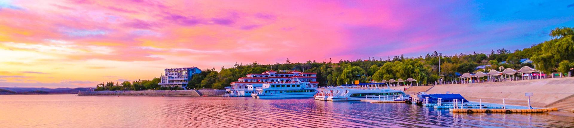
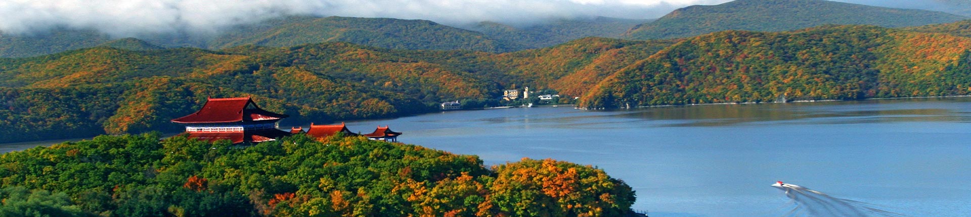
Jingpohu is a UNESCO‑recognised Global Geopark and a national AAAAA‑level tourist attraction.
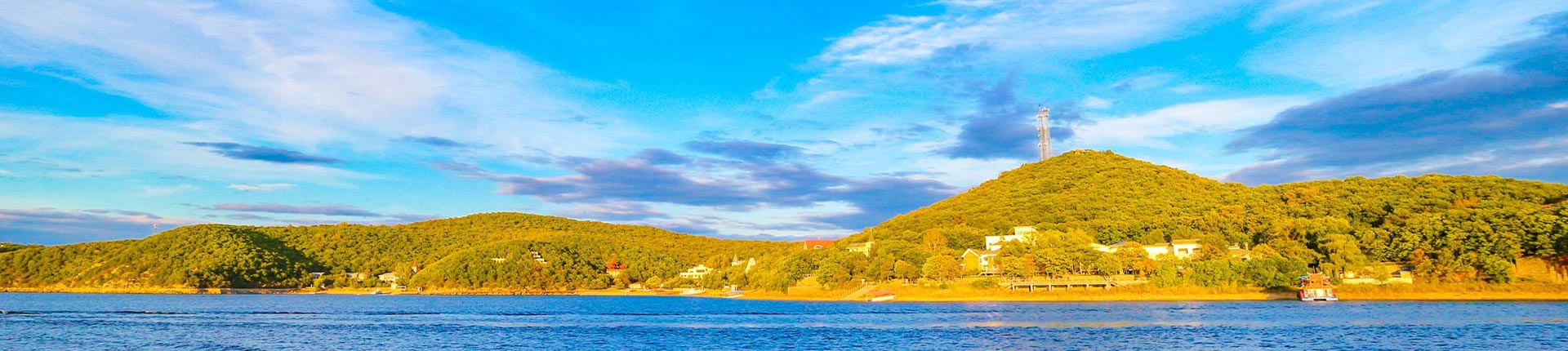
Located in Ning’an City, Mudanjiang, Heilongjiang Province, the geopark sits at the northern end of the Cenozoic magmatic belt in eastern China and on the western side of the Tan‑Lu Fault Zone, Asia’s largest fault zone. Covering a total area of 1,400 square kilometres, it is China’s largest and the world’s second‑largest volcanic lava barrier lake. Formed by volcanic activities over hundreds of millions of years, Jingpohu functions as an integrated tourist destination combining geological popular science, ecological sightseeing, historical tracing and folk‑custom experience, and is reputed as “a bright pearl on northern frontier”. Preserving complete relics of geological evolution, the park serves as a natural volcanic museum recording the vicissitudes of the earth.
Beneath the Earth’s crust, at depths of 100‑150 kilometres, lies a high‑temperature, high‑pressure magmatic liquid zone filled with silicate melts containing volatile components. When magma breaks through the crust at weak zones, volcanoes are formed.
Radiometric dating shows the Earth is 4.54 billion years old. Its structure is divided into outer spheres and inner spheres.
Outer spheres: the atmosphere, hydrosphere and biosphere. Their interactions jointly build the living environment on the Earth’s surface.
Inner spheres: the crust, mantle and core. Thermal convection in the mantle drives plate movement and shapes diverse landforms across the globe.
Eight elements‑oxygen, silicon, aluminium, iron, calcium, sodium, potassium and magnesium‑dominate the crust, accounting for 98 % of its total mass. Geological processes turn these elements into minerals, and minerals aggregate to form rocks. According to genesis, rocks fall into three categories: igneous, sedimentary and metamorphic rocks. Continuous transformation among the three constitutes the core of Earth’s material cycle.
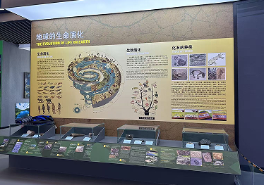
More than just a planet of rocks, the Earth nurtures abundant life. Some 3.5 billion years ago, cyanobacteria‑the earliest primitive life‑emerged in oceans. Through photosynthesis, cyanobacteria altered atmospheric composition and laid foundations for complex life forms.
Life has experienced a long‑drawn‑out and magnificent evolutionary journey:
In the Palaeozoic Era, marine organisms thrived. Fish gradually moved onto land, followed by amphibians and reptiles.
The Mesozoic Era was the age of dinosaurs, when reptiles reached their peak, while birds and mammals first appeared.
In the Cenozoic Era, mammals flourished and human beings emerged, ushering in the age of civilisation.
Fossils offer direct evidence of life evolution. After organisms die, organic matter decomposes, and hard parts such as bones and shells become fossilised together with sediments. Like word‑less books, fossils record key chapters of biological evolution on Earth.
All landforms on Earth are sculpted by geological processes, which are classified into endogenic and exogenic processes.
Endogenic geological processes are powered by internal Earth energy, including crustal movement, earthquakes and volcanic eruptions. They uplift land and form basic landform patterns such as mountains, plateaus and basins.
Exogenic geological processes are driven mainly by solar radiation and gravity. Weathering, erosion, transportation and deposition belong to this category, constantly reshaping surface features.
Plate tectonics represents a major form of endogenic geological activity. The lithosphere is broken into multiple plates floating slowly on the asthenosphere. Plate collision, compression and tension create global volcanic‑seismic belts, orogenic belts and oceanic trenches. There are two major global volcanic‑seismic belts:
Circum‑Pacific Volcanic‑Seismic Belt: stretching 40 000 kilometres, hosting 80 % of the world’s volcanoes with intense geological activities.
Mediterranean‑Himalayan Volcanic‑Seismic Belt: traversing Eurasia and parts of Africa, where earthquakes and volcanic eruptions frequently occur.
Volcanoes are landforms built by erupted magma. By activity status, they are grouped into three types:
Active volcanoes: currently active or erupt periodically, with about 500 examples worldwide.
Dormant volcanoes: with recorded eruptions in history yet long‑term quiescence. Changbai Mountain Tianchi is a typical example.
Extinct volcanoes: erupted in prehistoric times with no recorded eruptions in human history and no potential for future eruption.
In terms of eruption patterns, volcanoes can also be fissure‑erupted, central‑erupted or permeation‑erupted. Different eruption styles produce vastly different volcanic landforms.
Volcanic eruptions may bring disasters, yet they also bestow precious resources.
Fertile soils: volcanic ash is mineral‑rich and weathers into highly arable soil suitable for agriculture.
Minerals and energy: volcanic zones often host metallic mineral deposits, geothermal resources and mineral springs.
Tourist attractions: spectacular volcanic landforms constitute valuable tourist resources.
Volcanoes have profoundly influenced human civilisation. Ancient ancestors made tools from obsidian produced by volcanoes; ancient societies built buildings and sculptures with volcanic rocks; in modern times, geothermal heat is harnessed as clean renewable energy.
Spanning 1,400 square kilometres, Jingpohu Global Geopark lies within a major volcanic zone in eastern China. It preserves complete Holocene lava landscapes, functioning as a natural volcanic geological exhibition hall and an important base for researching Cenozoic volcanic activities in China.
Major honours:
August 2005: designated as a National Geopark of China.
September 2006: formally admitted to the UNESCO Global Geopark Network.
Three major eruptive episodes took place in the Jingpohu volcanic group, dated to 12 000 BP, 8 300 BP and 5 140 BP. Hot basaltic magma flowed down valleys and formed lava tunnels with a total length exceeding 27 kilometres. Lava flows blocked the ancient Mudanjiang River channel, giving rise to Jingpohu‑China’s largest volcanic lava barrier lake‑as well as secondary barrier lakes including Xiaobeihu and Zuanxinhu. A set of typical, rare and systematically‑preserved volcanic geological relics was left behind.
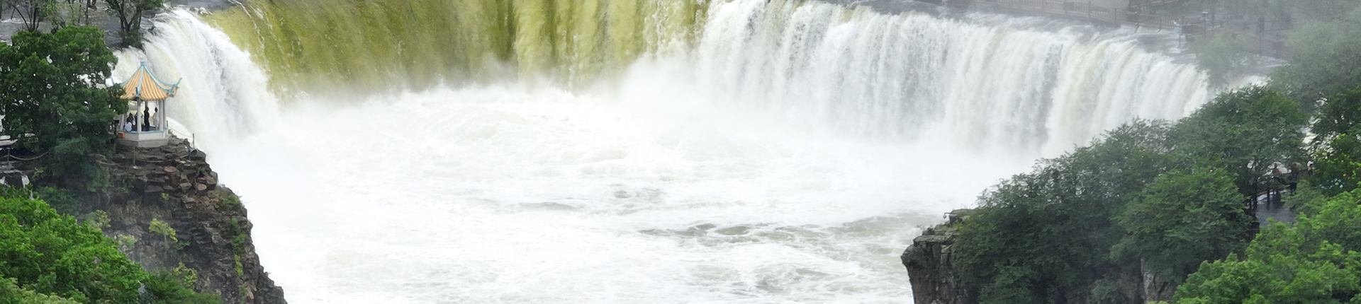
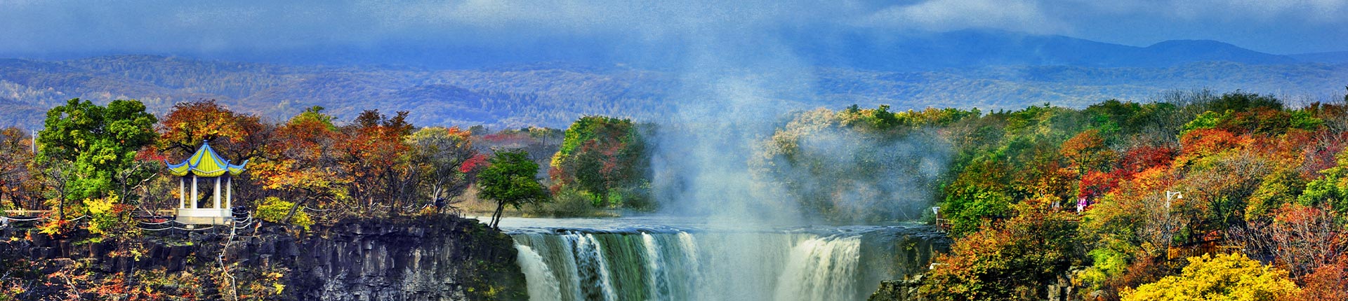
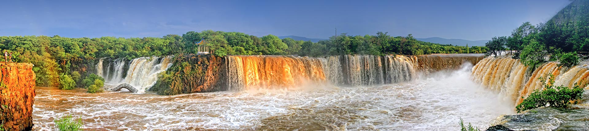
As the landmark of Jingpohu, Diaoshuilou Waterfall is China’s only lava‑collapse waterfall and the world’s largest basalt waterfall.
Situated at the contact zone between the lava platform and ancient granite, it serves as the outlet where lake water discharges into the Mudanjiang River. Normally 70‑odd metres wide with a drop of 20 metres, the waterfall can reach a maximum width of 300 metres in flood seasons with peak discharge of 4 000 cubic metres per second. Beneath the waterfall lies the circular Black Dragon Pool, 38 metres deep and up to 160 metres in diameter. Its walls consist of mid‑Jingpohu basalt with well‑developed columnar jointing.
Together with Huangguoshu, Hukou, Nuorilang, Wenlong and Sandiequan waterfalls, it ranks among China’s Six Great Waterfalls. In summer, surging water generates roaring sounds; in winter, it freezes into a giant 20‑metre‑high icefall crystal‑clear like a crystal palace, representing a famous winter landscape in Northeast China.
The Jingpohu volcanic group hosts abundant geological relics:
Volcanic cones and craters: sixteen volcanoes of varying sizes are scattered across the park, ranging from tens to hundreds of metres in diameter. Four craters in the Crater Forest area are exceptionally well‑preserved.
Lava platform: basaltic lava cooled into a 187‑square‑kilometre lava platform, acting as a natural laboratory for interpreting volcanic eruption processes.
Lava tunnels: caves formed when surface lava solidified into crust while internal magma drained away. Some tunnels stretch for kilometres, featuring unique structures such as lava stalactites and lava cascades.
Spatter cones and spatter sills: formed when volatiles inside lava interacted with groundwater, and intermittently ejected gas piled up molten lava. They constitute precious physical specimens for studying volcanic eruption mechanisms.
These relics fully reconstruct the whole process of volcanic eruptions and boast outstanding scientific research value.
Jingpohu features a temperate continental monsoon climate with well‑developed mountainous coniferous‑broad‑leaved mixed forests. Vegetation coverage exceeds 90 %, and over 1 000 higher plant species have been recorded. It represents a typical zone for Korean pine‑broad‑leaved mixed forests in Northeast China. Precious tree species such as Korean pine, spruce, fir, amur cork‑tree and Manchurian linden are widely distributed, many of which are nationally‑protected endangered plants.
Favourable natural conditions provide habitats for wildlife:
More than 50 mammal species: Amur tiger, black bear, brown bear, sika deer, roe deer, wild boar, etc.
More than 40 bird species: red‑crowned crane, oriental white stork, golden eagle, mandarin duck, etc.
More than 40 fish species: bighead carp, crucian carp, common carp, silver fish and others. The local fish group known as “Sanhua‑Wuluo‑Shibazi” enjoys high renown.
Jingpohu acts as a natural gene bank for flora and fauna and an important ecological security barrier for Northeast China.
Unique wetland ecosystems have developed on basalt platforms formed by volcanic eruptions ten thousand years ago. Basalt features good water‑resistance. Water accumulates in low‑lying areas to form numerous lakes and marshes, where reeds, wetland grasses and deciduous broad‑leaved trees thrive, creating distinctive wetland scenery on lava platforms.
Such special wetlands serve as breeding and inhabiting grounds for large numbers of water birds and perform hydrological regulation functions, forming an indispensable component of the Jingpohu ecosystem.
Jingpohu boasts a long human history with different names recorded in ancient documents:
Recorded as “Meituo River” in The Book of Han · Treatise on Geography of the Han Dynasty.
Named “Abu Lake” (also “Abulong Lake”) in 652 AD, the second year of Yonghui reign under Emperor Gaozong of the Tang Dynasty.
Called “Wuhanhai” in 713 AD, the first year of Kaiyuan reign under Emperor Xuanzong of the Tang Dynasty.
Referred to as “Puying River” in the Liao Dynasty.
Officially named Jingpohu in the Ming Dynasty, meaning “water as smooth as a mirror”. This name has been used ever since.
Near Jingpohu in Bohai Town stand the ruins of Shangjing Longquanfu, capital of the Bohai Kingdom‑a local regime founded by the Mohe ethnic group.
Founded in 698 AD, the Bohai Kingdom‑historically known as “the Prosperous State of East Sea”‑reached its heyday with territory covering most of Northeast China, northern Korean Peninsula and the Russian Far East. It had fifteen successive monarchs and lasted for 229 years. Its institutions imitated those of the Tang Dynasty; Chinese characters were widely used. It enjoyed prosperous economy and culture and maintained close contacts with the Tang imperial court.
As the primary capital of Bohai Kingdom, Shangjing Longquanfu adopted the urban layout of Chang’an City of the Tang Dynasty, consisting of outer, inner and palace cities, with a perimeter of nearly 17 kilometres. It was once the largest city in Northeast China. The Stone Lantern at Xinglong Temple on‑site is a complete large‑scale stone carving surviving from the Bohai period. Standing six metres tall and carved and stacked from basalt, it features exquisite craftsmanship and counts as a precious historical relic.
Surrounding Jingpohu live multi‑ethnic communities including Manchu and Korean peoples, who have nurtured rich folk culture.
Hunting‑fishing culture: The millennium‑old winter fishing tradition of Jingpohu. When the lake freezes in winter, fishermen follow ancient techniques to cut ice and cast nets. Up to hundreds of thousands jin of fish can be caught in one haul, presenting spectacular scenes.
Manchu culture: Intangible cultural heritage items such as Manchu paper‑cutting, Mohe embroidery and Shaman folk customs are well preserved.
Korean culture: Traditional songs, dances, costumes and cuisines of the Korean people have been passed down.
Visitors may taste local specialities including iron‑pot stewed fish, Korean cold noodles and rice cakes, and fully experience multi‑ethnic folk customs of Northeast China.
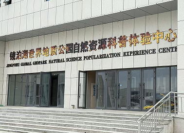
Since joining the Global Geopark Network in 2006, Jingpohu Global Geopark has adhered to the philosophy of “Priority to Conservation, Scientific Utilisation and Sustainable Development”, and carried out continuous work in geological research, ecological protection and geoscience popularisation.
Regular popular‑science events are held, offering geological lectures for primary, secondary and university students.
Thematic campaigns are organised to popularise earth‑science knowledge among the public.
Cooperative teaching and field‑practice bases are jointly built with universities to support geological research.
Construction of the geopark drives sustainable socio‑economic development of local regions.
Ecological agriculture is promoted. Brands of special agricultural products such as Xiangshui rice and Jingpohu lake fish are strengthened for higher added value.
Leveraging the geopark brand, eco‑tourism is developed, boosting local agritainment and homestay industries.
Local residents are encouraged to participate in park construction so that communities can share development gains, achieving coordinated progress between ecological conservation and improvement of people’s livelihood.
As a member of the Global Geopark Network, Jingpohu maintains exchanges and cooperation with geoparks worldwide to share experience in relic conservation and park operation.
In the future, Jingpohu Global Geopark will fully exploit its core resources including volcanic relics, long lake scenery and underground forests. It will further improve popular‑science supporting facilities and strive to build a world‑class tourist destination integrating geological study tours, ecological health preservation and four‑season sightseeing, enabling this bright pearl forged by volcanoes on China’s northern frontier to shine enduringly.